



C-Map Max
C-MAP MAX NA-M026 - Great Lakes & The Maritimes - SD™ Card
$291.00


In most cases, this item shipped can be returned for a full refund. Please read our Return Policy
Product Details
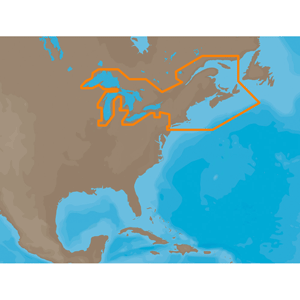
NA-M026 => Great Lakes, Northeast Coast and Approaches
Coverage of the Great Lakes, St. Lawrence River and Northeast United States. Coverage of the Great Lakes also includes Fox River and Lake Winnebago, Lake St. Clair, Rideau Canal, Ottawa River and the Trent-Severn Waterway. Includes all coastal charts for New Brunswick and Nova Scotia in Canada and Maine, New Hampshire, Massachusetts, Connecticut and New York in the U.S. Also included is coverage of the Hudson River and Lake Champlain as well as the Erie Barge Canal.This product may not be returned to the original point of purchase. Please contact the manufacturer directly with any issues or concerns.
You May Also Like


Copyright © 2026 Boatzon™. All Rights Reserved